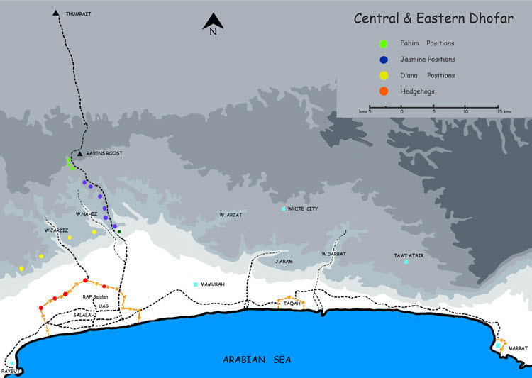
Arzat, Wadi A wadi ten miles to the north west of Salalah [ Map ] Ashoq
BATT British Army Training Team or the Special Air Service
CAT ( Civil Action Teams )
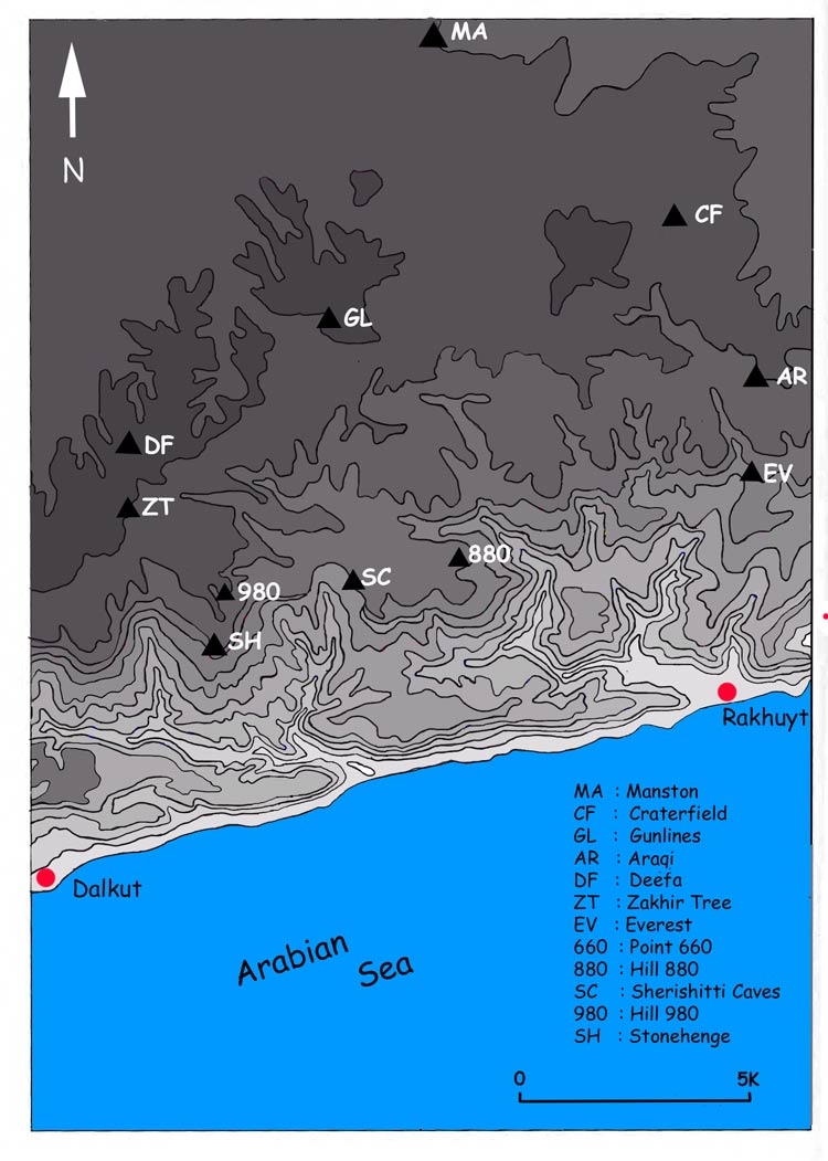
Darbat, Wadi A wadi ten miles to the north west of Salalah Deefa Defensive position two and a half miles to the north west of the Sherishitti Caves on the top of the jebel. [ Map ] Dharab, Op A SAF operation to attack Sherishitti in January 1975 Diana Line Four defensive points on the edge of the jebel ten miles north of Salalah. It straddles the Wadi Jarsis [ Map 1 ] [ Map 2 ]
Empty Quarter The great sand desert to the north and west of Oman
Firqat Groups of jebali tribesment 50 to 150 strong who were encouraged to fight on the Government side. Notoriously fickle and unpredictable.
Gunlines Position on top of the jebel between Manston and Deefa
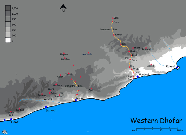
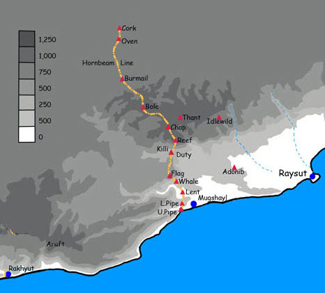
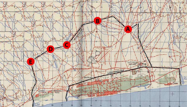
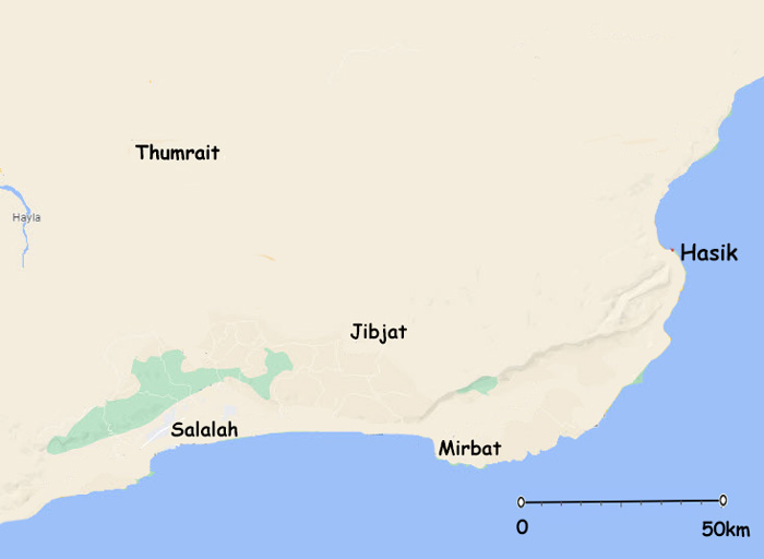
Hasik A fishing village 85 miles to the nort east of Salalah where the RE Troop did some of their acclimatisation by erecting a small corrugated iron school. [ Map ] Hauf Principal dissident stronghold just over the border in Yemen. [ Map ] Hadaf, Op ( Op Kahoof ) Operation to capture Furious Stonehenge and Sherishitti (1-15Nov) Diversion to move down from Capstan to the sea (16-17th Oct) Hedgehogs The “hedgehogs” were a numbers of fortified positions connected by dannert wire, manned by the RAF Regiment surrounding RAF Salalah which pushed the dissidents further back towards the jebel. [ Map ] Himaar, Op Operation to attack the 9th of June Regiment in the Wadi Ashawq. Hornbeam Line A line of dannert wire sown with anti-personnel mines and intermittent fortified posts stretching North for thirty four miles from Mugsayl on the coast towards the negd. A barrier to prevent resupply for the dissidents from Yemen. [ Map ]
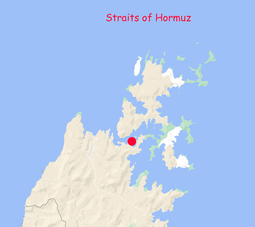
Intradon, Op An operation by British Units, TOS and SAF in 1970 -71 to secure the Musandam Peninsula and therefore establish control of the Straits of Hormuz rather than allowing the Arab Action Party to have influence there. [ Map ] Izki Regional town 95km to the southwest of Muscat and 20km east of Nizwa
Jaguar, Op Pacification of the Eastern Jebel after the 1971 monsoon by SAF with some help from the SAS. Jibjat Settlement 30 miles north east of Salalah and 2.5 miles west of Lympne [ Map ]
Kealy, Capt Mike Commander of the BATT at Mirbat Kahoof, Op ( Op Hadaf ) Diversion to move down from Sarfait to Capstan (14-15th Oct) Khasab Port town on the north of the Musanadam peninsula.
Labalaba Member of BATT killed early on in the Battle for Mirbat Lance, Op Attempt in May ’69 to penetrate the Sherishitti caves. Lympne Small airhead, 200 to 250 m long 4km to the east of Jibjat. Its surface quickly broke up at the commencement of Op Jaguar
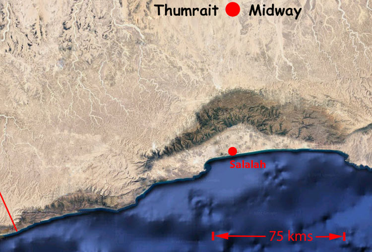
Madinat al-Haq ( White City ) Fifteen miles north east of Salalah [ Map ] Manston Small outpost with a landing strip which served as a supply base for Op Simba Midway ( Thumrait ) Forty miles due north of Salalah. [ Map ] Mirbat Large fishing village at the east end of the Salalah plain. [ Map ] Mugshayl
PFLOAG Peoples Front for the Liberation of the Occupied Arab Gulf
Qaboos
Raven’s Roost ( Qayrun Hayritti ) A position on the Midway Road twenty miles north of Salalah on the far side of the jebel. Named for a Capt Raven of MR. [ Map ]
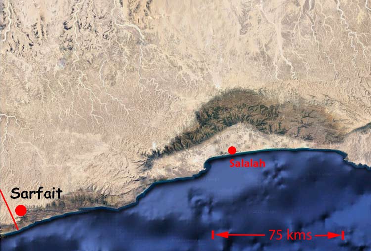
Said, Op An Iranian operation to the west of the Damavand Line to threaten the Sherishitti Caves. Sarfait. Strongpoint high on the jebel on the Yemeni border which formed the focus for Op Simba. Consisted of Yardarm to the North and Mainbrace to the South on the edge of the escarpment and at times Capstan below the escarpment. [ Map ] Seeb Connurbation just to the west of Muscat. Sherishitti Caves Insurgent stores complex under the edge of the jebel 24kms east of Sarfait [ Map ] Stonehenge Position overlooking Sherishitti Caves from 3kms south of Deefa. [ Map ]
Taqah Large village on the coast fifteen miles from Salalah and twenty miles from Mirbat [ Map ] Tawi Atair Sinkhole in the limestone plateau 170m deep and 90m across at its widest. It was a reliable source of water for the surrounding jebel which was enhanced when the RE installed electric pumps. [ Map ] Telegraph Island [ Map ]
Thumrait ( Midway ) Forty miles north of Salalah. It now has a 2.5 mile runway [ Map ]
Umm al Guariff SAF and BATT HQ in Dhofar to the east of Salalah
Watts, John ( Lt Col ) CO BATT Western Dhofar [ Map ] [ Map 2 ] [ Map 3 ] White City ( Madinat al-Haq ) Fifteen miles north east of Salalah. [ Map ]
Yardarm A main defensive position on the Yemeni border near Sarfait created as part of Op Simba [ Map ]