Photographs of The Sultanate of Oman
and The Sultan’s Armed Forces 1974 – 76

LINKS

A  sketchmap of Oman in 1974

About this site
A sketchmap
Related Books
Civil Aid Develops

EXTERNAL LINKS
55 FST RAMC
SASC Comrades
SAF Association

KDesign accepts no responsibility for external links or the contents therein

Oman was very underdeveloped. One major Airport at Seeb (15 Km west of Muscat) on the Batinah coast, and Seeb – Muscat was the only single carriageway ‘blacktop’ road in the North of Oman. No telephone system, and the only way to telephone UK was from three booths in the Cable & Wireless office in Muscat, and only after waiting for hours in queue or for a line to the outside world. Travel to the interior was restricted (to non military). Roads were ‘graded’ gravel or sand tracks.
 
The male population wore traditional dress which included a rifle and ‘Kunjar’ (curved dagger), and mainly walked or used donkeys and camels, although a toyota pickup ‘invasion’ very rapidly added to the road dust (and casualty rate) during travel. (Carrying of firearms by civilians was phased out in 1976).
 
The Batinah coast of the north formed a coastal plain of up to 12 Km from sea to a high mountain range (Jebel Akhdar – 2980M near Sayq) with very few wadi ‘passes’ to the interior. Ruwi and Muttrah were population centres just on the western side of Muscat, and the main oil depot and terminal PDO ( Petroleum Development Oman) was at Mina al Fahal a couple of Km further west on the coast.
 
Nizwa was the main town on the southern side of the Jebel Akhdar from which the desert stretched southwards to Thumrait (Midway). Fahud was the main oilfield south west of Nizwa. The western borders of Oman with Saudi Arabi and UAE were, and are even today ill-defined and disputed.
 
The island of Masirah off the east coast was a strategic RAF base.
 
In the Dhofar region Salalah was an airbase with RAF support, and a few Km southwest was the small port of Raysut. Again a flat coastal plain from Salalah then rose to the ‘jebel’ which was rocky and scrub covered with deep wadis and thick vegetation. Further west harsh rocky mountains with cliff edged wadis rose directly from the sea to heights of up to 1400 metres. Inland, beyond the effects of the Khareef, a ‘moonscape’ was encountered leading to flat desert in the Thumrait region to the PDRY border, or north towards Haima.
 
The Dhofar War, a rebellion by the ‘jebalis’ (mountain tribesmen with support from communist Yemen and elsewhere), had been underway since 1965, and in 1972/73 had all-but surrounded and was threatening Salalah. The ‘adoo’ (enemy) had occupied the Jebel overlooking the coastal plain. Mirbat further east was isolated. In Northern Oman the terrorism threat was well monitored and contained.
 
The North was extremely hot and humid with annual downpours that created flash flooding, and Dhofar, also hot and humid, received a ‘monsoon khareef’ (constant mist and rain or drizzle) during most summer months June – September from the Arabian Sea. Dhofar turned green during summer but grass soon burned out in Oct/Nov.

Scale examples.
Muscat – Sohar approx 200 km
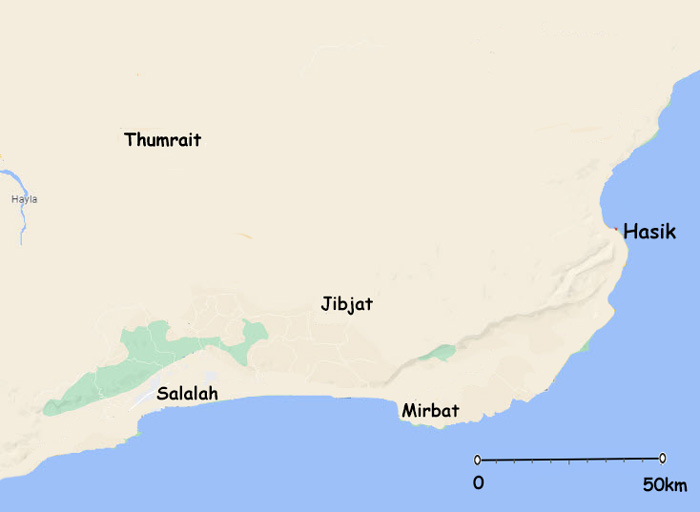
PDRY Border – Mirbat approx 170Km
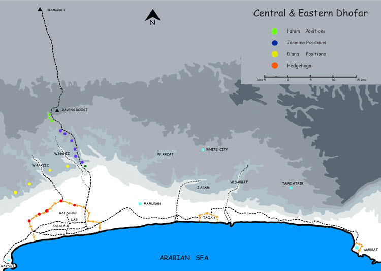
DEVELOPMENT

By April 1976 civil development was very apparent. Roads were being constructed both in the north and south, hospitals and schools were being built, sports facilities were under way, and a National Police Force had been established.

A new residential town (Madinat al Qaboos) was under construction near the oil terminal, and there was an increase in the ex-patriot population supporting development and services.

POSTSCIPT

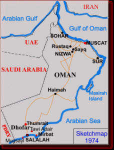
DJC returned to Oman in 1979, modern hotels were available, and by mid 1980 blacktop roads had reached Haima in the desert interior, communication systems had been modernised, schools, medical and education facilities had developed tremendously, and ‘Omanisation’ of Armed Forces Command structures was well advanced.

Copyright © 2013 KDesign

EMAIL  : post@biziness.co.uk

Web Site 3rd Edition

Sn Sarfait 750x507 Web
Western Dhofar 23 Nov 22 Web 750x544
Sherishitti Sh 980 Deefa 750x656
Sherishitti Caves
Dianas Web 600
Sn Hawf 750x507
Hawf