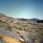
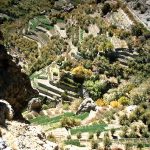
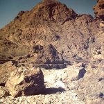
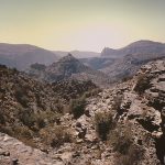
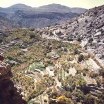
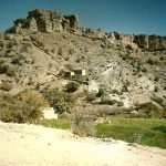
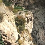
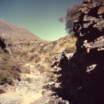
Sayq area is near the top of the Jebel Akhdar (Green Mountain) and in 1974 was only accessible by air or after a long climb on foot using a narrow ‘goat track’. 2980 metres above sea level, it has a most agreeable climate, clear air and much cooler than at sea level. In winter it can have snow, frosts and ice. There is a 300 metre long airstrip on a plateau just above Sayq village, and off the plateau in the ravines and wadis are some amazing villages and terraced cultivation. Ancient yet well maintained ‘falaj’ systems irrigate fields and provide water to the villages. In the late 1950’s Sayq was a rebel stronghold that was eventually subdued with the help of SAS climbing the jebel for an assault. An army presence was maintained with a field firing ‘Battle Camp’ as part of the Training Regiment. For more information on the 1950s history of the area and in particular Sayq, select the link to the 2008 Laurence Garey article which makes fascinating reading with excellent photographs.